Citizen Scientists and Machine Learning
In the age of big-data, ecologists are faced with the big-problem of answering the question: "How do we analyze all this data!?". Technologies like camera traps and drones produce terabytes of data every field season, and this quickly becomes overwhelming to go through by individual researchers. One potential solution is citizen scientists, who are increasingly being recruited to help sort through remotely sensed imagery. Another method is advanced machine learning techniques to automatically identify features of interest, but these take time to develop and train. In combination, these two approaches may offer an elegant solution to big-data problems! By partnering with computer scientists, we are working towards integrating citizen scientists and machine learning techniques, to help survey wildlife with remote sensing technologies. This research is headed by Dr. Travis Desell at the Rochester Institute of Technology and Dr. Susan Ellis-Felege at the University of North Dakota.
Citizen Scientists
The first step in this research was to build an online database called Wildlife@Home for all of the drone and camera imagery to be stored and easily viewed by citizen scientists. Constructing a friendly user interface makes data collection easier for members of the public, and ultimately results in higher data quality for the scientists. Anyone who is interested can go to the Wildlife@Home website and sign up to review imagery. Currently, the Wildlife@Home database is hosting over 2 million individual images of wildlife and their habitat, taken by our drones and cameras!
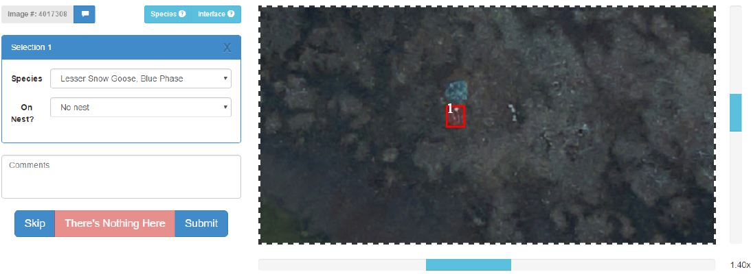
The Wildlife@Home interface for drone imagery of nesting snow geese. Though difficult to tell, this example shows a drawn box around a blue snow goose. Figure from Mattingly et al. 2016
Machine Learning
|
The next step of the project is to use citizen scientist's detection of wildlife (geese) to train machine learning algorithms for automated detection. Here, classified data is used as input data to Convolutional Neural Networks (CNN's), a type of machine learning which will ultimately produce estimates of how many geese are detected in an image. This data can then be used to estimate nesting density across much broader scales than is currently feasible by researchers on the ground. Updates to come on the progress of this work!
|
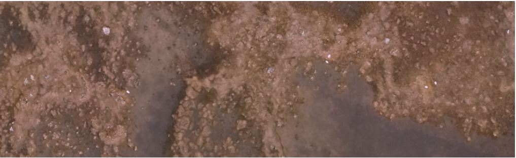
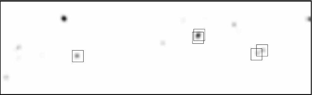
Top: a portion of drone imagery containing white phase snow geese. Bottom: A CNN prediction over the image. Figure and caption modified from Bowley et al. 2018
|
Relevant Publications
Bowley, C., Mattingly, M., Barnas, A.F., Ellis-Felege, S.N., and T. Desell. 2019. An analysis of altitude, citizen science and a convolutional neural network feedback loop on object detection in unmanned aerial systems. Journal of Computational Science. https://doi.org/10.1016/j.jocs.2019.04.010
Bowley, C., Mattingly, M., Barnas, A.F., Ellis-Felege, S.N., and T. Desell. 2018. Detecting wildlife in unmanned aerial systems imagery using convolutional neural networks trained with an automated feedback loop. International Conference on Computational Science. 69-82 https://doi.org/10.1007/978-3-319-93698-7_6
Bowley, C., Mattingly, M., Barnas, A.F., Ellis-Felege, S.N., and T. Desell. 2017. Toward using citizen scientists to drive automated ecological object detection in aerial imagery. IEEE 13th International Conference on e-Science. 99-108. https://doi.org/10.1109/eScience.2017.22 PDF
Mattingly, M., Barnas, A., Ellis-Felege, S.N., Newman, R., Iles, D.T., and T. Desell. 2016. Developing a citizen science web portal for manual and automated ecological image detection. IEEE 12th International Conference on e-Science. 223-232. https://doi.org/10.1109/eScience.2016.7870903 PDF
